PREVIOUS
Australia’s Railways Accelerate Towards 5G and Future Railway Mobile Communication System (FRMCS)


Emergency 112: An inaccessible accident or a forest fire is spreading rapidly. For rescue teams, every second counts – but they often lack decisive information on the operation site or the situation on the ground. Especially in complex, hard-to-reach areas such as forests, crews often reach their limits in the crucial first few minutes, because many details remain unclear over the phone.
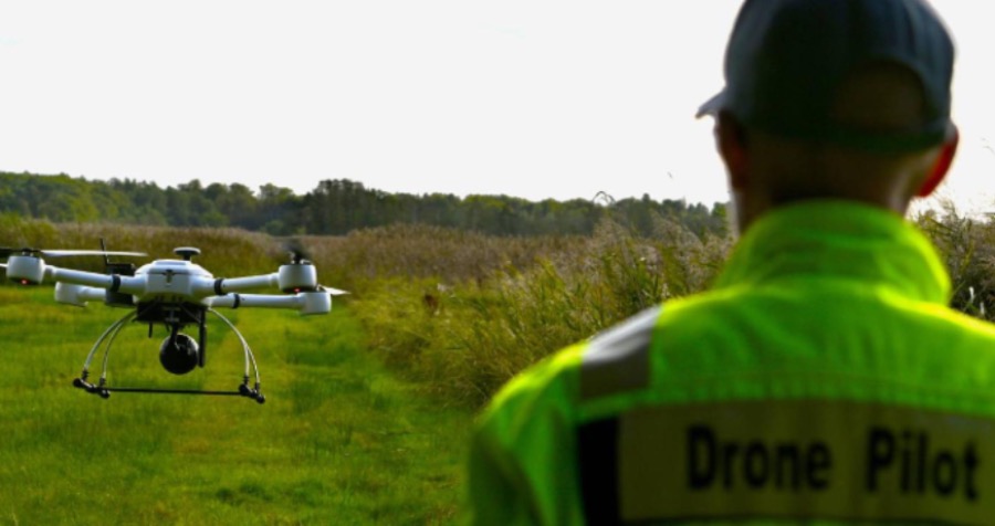
To improve this situation Vodafone, the Rostock Fire Brigade, and Frequentis have joined forces under the leadership of the German Aerospace Center (DLR) in the ADELE funding project: with 5G-controlled drones, emergency services receive high-resolution live images directly to the control centre and emergency vehicles before arriving at the scene.
“When people’s lives are at stake, every second counts. We now provide emergency services with a digital tool that allows them to act faster and safer in emergency situations. Because drones share live images from the operation site even before rescue workers arrive there. This enables crews to help people in need much faster,” explains Michael Reinartz, Director Innovation at Vodafone Germany.
5G drones: operational support from the air
In this project, Vodafone’s 5G technology is combined with existing LifeX and ASGARD control centre software from Frequentis. If an emergency call is received that requires the deployment of a drone, the drone is automatically dispatched directly from the control centre. It flies completely automatically beyond visual line of sight (BVLOS). The DLR’s special rescue drone with high-resolution camera sensors then heads directly to the scene of the emergency and transmits high-resolution live video data directly to the control centre via Vodafone's 5G real-time network – even before the first emergency vehicle leaves the control centre. This provides emergency responders with important visual information, such as fire development, access routes, potential hazardous material storage locations, and the presence of people in the affected area. This information enables a more targeted planning of the required emergency units, reducing the average response time from over nine minutes to around two minutes. A clear time gain that can save lives.
“We bring video and sensor data immediately to our LifeX or ASGARD control centre and to the approaching emergency responders. This ensures that everyone involved in the operation has the same, consistent information about the scene immediately, and at all times, regardless of location. This shared situational awareness accelerates decision-making and ensures a faster, appropriate, and effective response to the situation,” says Günter Graf, Vice President New Business Development at Frequentis.
Simplification for control centre systems
Frequentis and the DLR ensure smooth implementation in practice by integrating drone control directly into existing control centre technology such as the ASGARD or LifeX communications systems. Frequentis' Automated Drone Dispatch System (ADD) is connected via a special interface. When an emergency call is received, the control centre software can transmit the location determined from the emergency call data to the ADD as geocoordinates. The ADD then suggests a possible drone deployment based on GPS data and the location of the incident.
“Our rescue drone combines high-resolution camera sensors with an optimised and low-risk flight trajectory based on current movement data. We ensure compliance with all legal regulations and full GDPR compliance to guarantee both security and data protection,” says DLR project lead Andreas Volkert.
Safe drone flights and faster approvals through DroNet Hub
BVLOS flights (drone flights beyond visual line of sight) underly strict regulations, especially in inhabited areas. For approvals, ground and traffic data must assess the risk and enable safe flight routes. Vodafone has developed the "DroNet Hub" for this purpose – a platform and a complementary tool that provide current and dynamic data to make drone flights safer and approval processes more efficient. Authorities are already using this data to assess and ensure the safety of drone traffic.
More speed and security for emergency responders
“With ADELE, we bring more speed and clarity to the daily operations of police, fire departments, and other emergency services. Live images provide emergency responders with valuable information that not only gives a better overview but also saves valuable time. This allows for faster and more accurate decisions and an even faster response,” says Chris von Wrycz Rekowski, Senator for Finance, Digitalisation, and Order of the Hanseatic and university city of Rostock.
The project now starts with first operations. The long-term goal is to integrate the automated drone
deployment into the daily routine of authorities and organisations.